Blue Carbon Intelligence • Climate Mitigation Assessment • 2025

Blue Carbon Monitoring Project

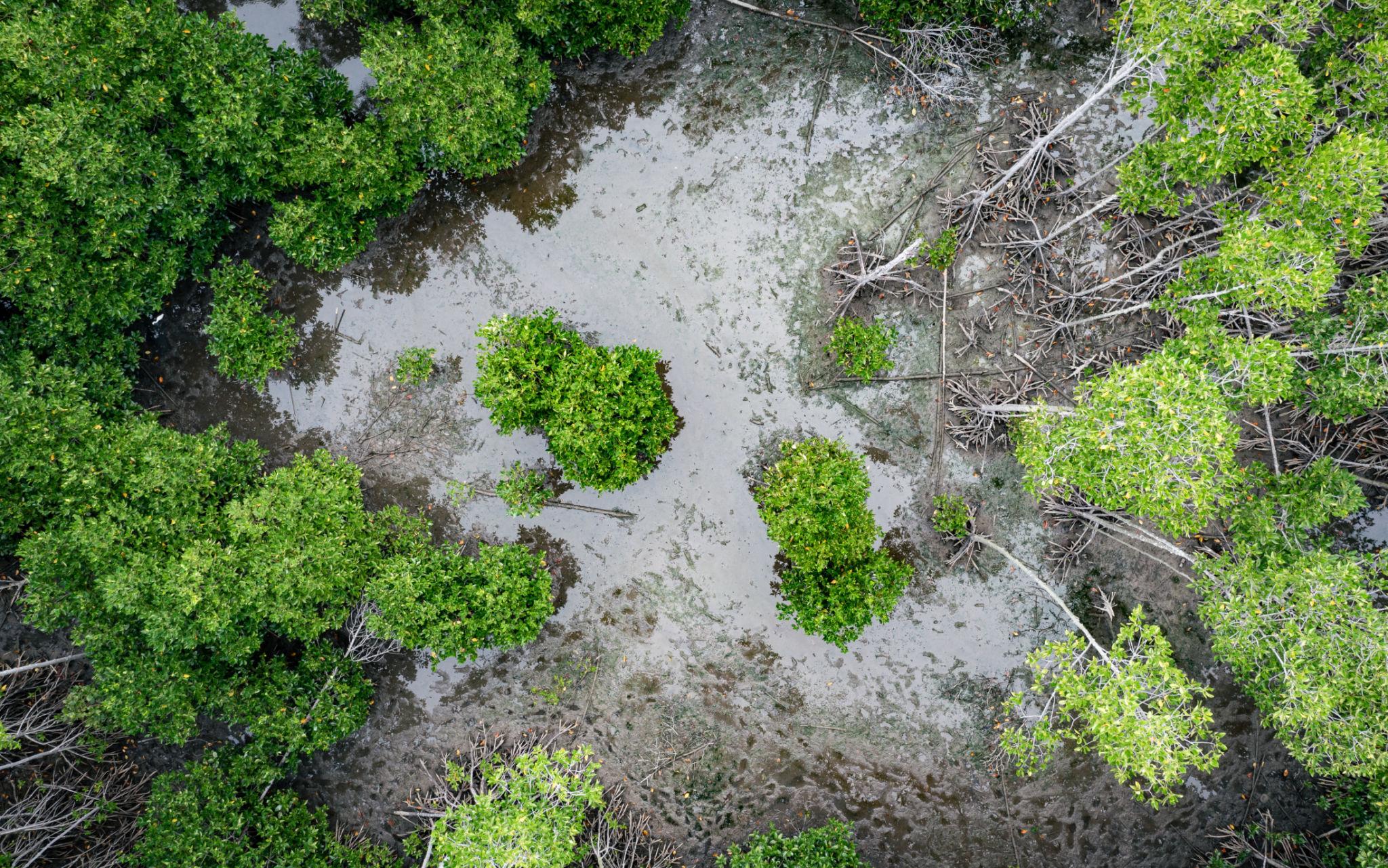
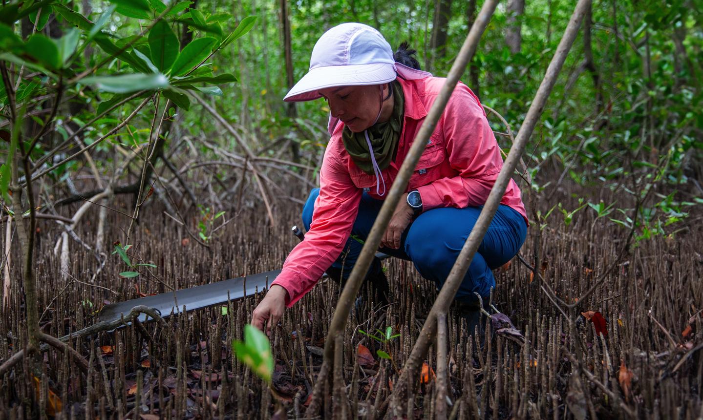
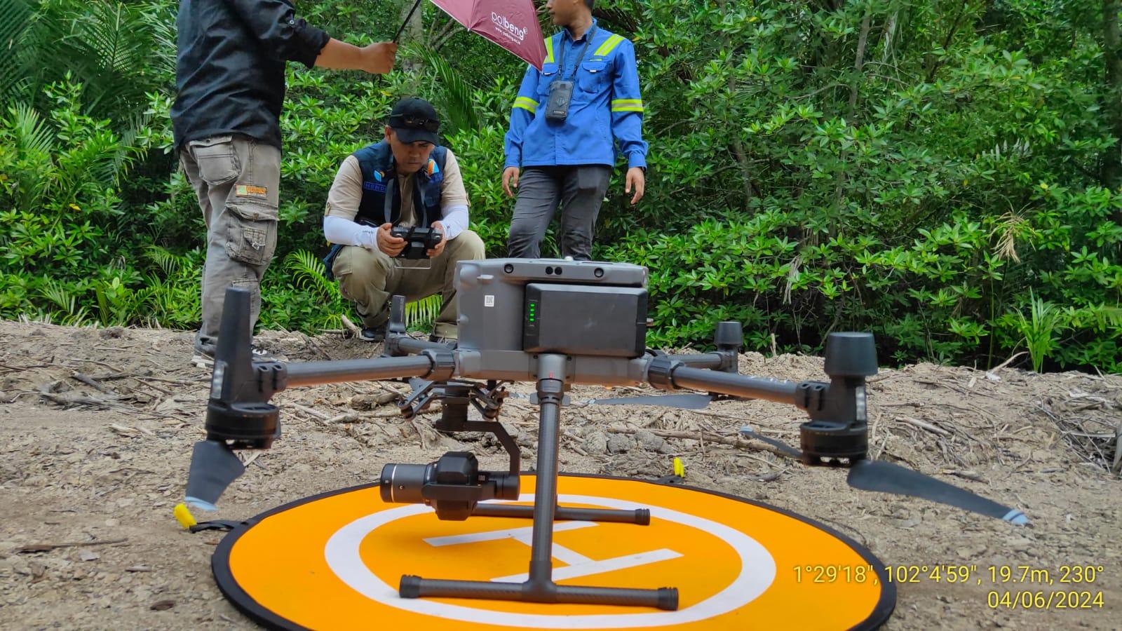
Advanced coastal carbon intelligence program quantifying carbon stocks, monitoring sequestration dynamics, and supporting climate mitigation strategies through science-based ecosystem assessment. Blue carbon ecosystems store large volumes of carbon in biomass and sediments, making them critical natural assets for long-term climate mitigation and carbon accounting.

14,500
Hectares Assessed
Mangrove, salt marsh, and seagrass landscapes mapped for carbon inventory development and monitoring prioritization.
1.82 Million tCO₂e
Carbon Stock Estimated
Aboveground and belowground carbon pools quantified using field sampling, remote sensing, and spatial modeling.
58
Monitoring Stations Established
Permanent stations supporting repeated measurements of carbon dynamics, ecosystem condition, and reporting consistency.
12
Carbon Indicators Tracked
Biomass, soil carbon, sediment depth, canopy structure, salinity, and change-detection indicators used for MRV.

Overview

Blue Carbon Intelligence Framework

The Blue Carbon Monitoring Project establishes a structured carbon intelligence framework for coastal ecosystems. The program develops carbon inventories, maps coastal ecosystem carbon distribution, and monitors sequestration pathways across mangrove, salt marsh, and seagrass environments. The resulting evidence base supports climate reporting readiness, carbon management decisions, and long-term monitoring of ecosystem carbon performance.

Core Strategy: Build a verifiable carbon baseline across 14,500 hectares; quantify aboveground and belowground carbon pools; track sequestration over time through MRV-aligned field and geospatial methods; and deliver decision-support for climate mitigation, carbon credit readiness, and nature-based climate action.

Challenge

Blue Carbon Data Deficiency & Reporting Gaps

Lack of Accurate Carbon Inventories: Coastal wetland carbon stocks are often estimated from sparse datasets, limiting confidence in baseline values and project-scale carbon accounting.

Insufficient MRV Systems: Many sites lack measurement, reporting, and verification frameworks needed to track carbon change consistently over time and support climate finance requirements.

Carbon-Rich Ecosystem Loss: Degradation, drainage, and land conversion reduce carbon storage capacity in mangroves, marshes, and seagrass meadows, creating major data gaps in sequestration monitoring and climate reporting.

Methodology

Integrated Carbon Assessment & Monitoring Framework

The project applies a carbon-focused methodology combining field sampling, remote sensing, spatial modeling, and long-term station-based monitoring to quantify blue carbon stocks, evaluate sequestration potential, and develop MRV-ready reporting outputs for climate and finance stakeholders.

PHASE 01

Carbon Baseline Assessment

Establishes the initial carbon inventory through soil carbon analysis, biomass estimation, sediment profiling, and ecosystem stratification to define baseline carbon stocks.

PHASE 02

Remote Sensing & UAV Carbon Mapping

Combines drone mapping, LiDAR assessment, and GIS analytics to map canopy structure, habitat extent, and spatial patterns of carbon density across coastal wetlands.

PHASE 03

Field Carbon Sampling & Verification

Validates remotely sensed estimates using biomass plots, sediment coring, soil carbon laboratory analysis, and site-level verification for carbon accounting accuracy.

PHASE 04

Carbon Modeling & Long-Term Monitoring

Applies carbon forecasting, change detection, and MRV framework development to track sequestration trends and sustain long-term monitoring for climate reporting.

Field Intelligence Gallery

Mangrove carbon stock assessment
Field teams conducting biomass and carbon stock measurements in mature mangrove ecosystems.
Soil carbon sampling operations
Collection and laboratory analysis of sediment cores to quantify belowground carbon storage.
Drone-based carbon mapping
UAV and multispectral imagery supporting carbon inventory development and ecosystem monitoring.

Technology Ecosystem

GIS Carbon Intelligence — Spatial analysis for carbon inventory development and hotspot mapping Remote Sensing Analytics — Multi-temporal monitoring of coastal carbon extent and condition UAV Carbon Mapping — Drone-based measurement of canopy structure and habitat-level carbon patterns LiDAR Vegetation Modeling — Structural estimation for biomass and aboveground carbon quantification Carbon Accounting Systems — Data pipelines supporting baseline establishment, tracking, and reporting Environmental AI — Pattern detection for carbon change, ecosystem classification, and anomaly screening Climate Intelligence Platform — Integrates field and remote data for climate reporting and decision support MRV Monitoring Frameworks — Measurement, reporting, and verification structure for carbon integrity Predictive Carbon Analytics — Forecasts sequestration trends and long-term carbon performance

Outcomes & Impact

✓ Carbon Baseline Established

A verified carbon baseline was created across mapped coastal wetlands, providing a reference for stock quantification, future comparisons, and reporting integrity.

✓ Carbon Hotspots Identified

High-density carbon zones were delineated to support prioritization of conservation, management, and potential climate finance opportunities.

✓ Sequestration Potential Quantified

Long-term sequestration potential was modeled using ecosystem condition, sediment depth, and vegetation structure to estimate climate mitigation value.

✓ MRV Framework Operational

Measurement, reporting, and verification workflows are operational, enabling repeatable monitoring and auditable carbon assessment outputs.

✓ Climate Reporting Readiness Achieved

Project data now supports climate reporting, carbon disclosure, and alignment with blue carbon accounting requirements.

✓ Nature-Based Climate Opportunities Identified

Nature-based climate solutions were screened for carbon value, long-term monitoring feasibility, and potential readiness for climate finance pathways.

"The project delivered a scientifically robust blue carbon baseline with clear MRV logic, defensible carbon estimates, and practical monitoring tools. It improved our ability to interpret carbon stocks, track sequestration change, and identify climate mitigation opportunities with confidence."

Senior Climate & Carbon Intelligence Advisor

Blue Carbon Programs Directorate